DEA Summary Product Grids (Collection 3)
Introduction
Digital Earth Australia (DEA) maintains and distributes collections of satellite-derived information sourced from a growing number of different satellite missions.
For DEA Collection 3, Analysis Ready Data and single-observation derivative products (e.g Fractional Cover, Water Observations) are distributed in their native Universal Transverse Mercator (UTM) projection in an effort to reduce:
complexity of our pipelines,
size on disk,
lossy re-projection of data from native coordinate reference system.
However, statistical summary products (e.g. geomedians) are produced from grids based upon Australian Albers projection (“EPSG:3577”). This makes all of DEA’s derivative products comparable across Australia.
What are the Collection 3 grids?
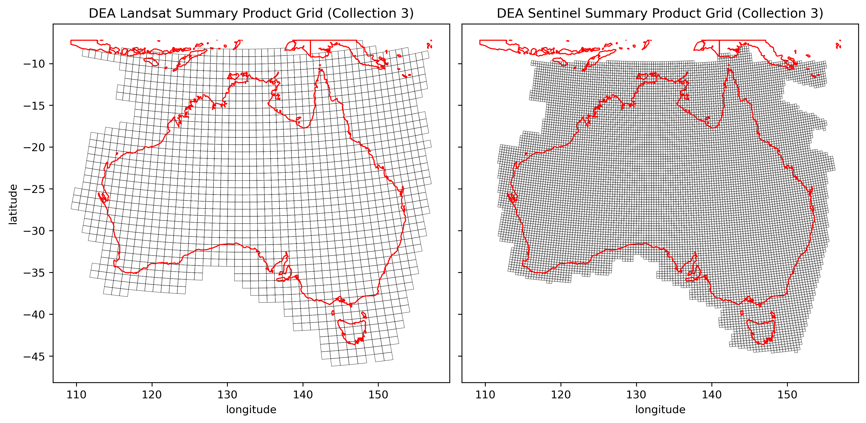
Landsat and Sentinel derivative products are built using two distinct grids.
We call these:
DEA Summary Grid Landsat (Collection 3)
DEA Summary Grid Sentinel (Collection 3)
The Landsat tile size is defined as \(96km^2\). This results in a raster size of \(3200 \times 3200\) pixels of \(30m^2\).
For Sentinel based products, the tile size is \(32km^2\) which results in a raster size of \(3200 \times 3200\) pixels of \(10m^2\). We build Sentinel products using smaller grid tiles to enable more efficient batch processing given the large data volumes involved.
Both grids are built from the same origin point, so the smaller tile size of the Sentinel grid fits neatly within the Landsat grid (i.e., nine Sentinel tiles fit evenly within one Landsat tile)
For compatibility with file system and web access tools and protocols, the grid has been defined to be non-negative, with the x00,y00 cell located in the South-Western corner of the grid, and positive numbers progressing Northward and Eastward.
The extent of these grids is based upon:
GDA94 / Australian Albers projection coordinate reference system (EPSG:3577),
DEA’s Landsat Collection 3,
DEA’s Sentinel-2 Collection,
The expanded extents of offshore islands, as detailed in DEA’s ARD expanded processing extent
Shown below is an image of both tile grids and their extents, clipped to mainland Australia so the grid sizes are visible.
How can I use these grids?
These tiling grids have been used to subdivide processing and
storage of our continental products.
These tiling grids can be used as an overlay in other spatial systems to
determine the xMyN reference of a given area of interest from within a
DEA Collection 3 summary product.
Data access
Use the links below to download the grids (as a GeoJSON), and/or view the grid extents.